Cargando...
Recursos educativos
-
Nivel educativo
-
Competencias
-
Tipología
-
Idioma
-
Tipo de medio
-
Tipo de actividad
-
Destinatarios
-
Tipo de audiencia
-
Creador
Lo más buscado
- Auxiliary verbs
- Cine y publicidad
- Actividades de vocabulario
- Acento palabras llanas
- método lectoescritura
- Experimento Torricelli
- Animales que respiran por la piel
- Israel y Fenicia
- Actividades para religion
- actividades lengua
- Ejercicios escolares para niños de 3 años
- Experimentos de ciencias
- Instrumentos de cuerda
- experimentos para niños
- Ejercicios resueltos
-
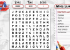
Game: Wordsearch
Tiching explorer Organización
- 1 lo usan
- 3418 visitas
In this game we need to find the hidden words in a grid. We can revise adjectives, vehicles, olympic spots, months of the year, zodiac signs, hotel, garden, colours, buildings, family, musical…
-
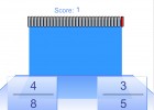
Fraction comparison
Tiching explorer Organización
- 3704 visitas
In this game students have 30 seconds to decide which of a pair of fractions is greater than or less than the other by drawing on the appropriate signs “<” or “>”. We can practice…
-
Getting to know yourself
INTEF Organización
- 1 lo usan
- 3419 visitas
In this unit we talking about ourselves, describing people personalities and abilities. We practice vocabulary (psychology and science, personality, astrology and zodiac signs). It includes a teacher's…
-
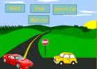
Labelling transport
Smart Organización
- 2607 visitas
Activity designed to help us learn/revise vocabulary related to transport and road signs. We label common objects with the appropriate words. We need to sign in to download the resource.
-
Number jumbler
BBC Organización
- 2494 visitas
Set of interactive games (Odd and even, Win the money, Missing signs, Rounding to the nearest 10 pence, and More or less) designed to practice mathematical skills. There are different levels of difficulty.
-

Unit 2: The representation of the Earth: maps
EduBook Organización
- 3511 visitas
Cartography (n): the process of making maps. conventional signs (n): symbols or colours used to represent the different elements on maps. coordinates (n): geographical coordinates are a system used to…
-

-

Self-evaluation 2 - Prehistory
EduBook Organización
- 7060 visitas
Which statements about prehistoric ages are true and which are false?: The cultivation of food began in the Fertile Crescent. The development of pottery allowed people to store and transport food.…
-
Travelling
Educajccm Organización
- 9 lo usan
- 5513 visitas
Interactive unit designed to help us practice asking and giving information about how to get to a particular place. We study prepositions, the time, traffic signs, means of transport, etc. We practice…
-

True/false. Map reading
EduBook Organización
- 5692 visitas
Indicate whether the following statements about maps are true or false: To successfully read a map we need a scale and a key. Maps use two types of scale: a numeric scale and a graphic scale. The key…
Te estamos redirigiendo a la ficha del libro...


